-
About Santorini
About Santorini
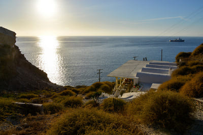
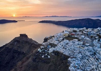
Crescent-shaped Santorini (or Thíra), the precious gem of the Aegean, is actually a group of islands consisting of Thíra, Thirassiá, Asproníssi, Paleaand Nea Kaméni in the southernmost part of Cyclades island complex.
Did you know that the whole complex of Santorini islands is still an activevolcano (the same as Méthana, Mílos and Nísiros) and probably the onlyvolcano in the world whose crater is in the sea? The islands that formSantorini came into existence as a result of intensive volcanic activity;twelve huge eruptions occurred, one every 20,000 years approximately,and each violent eruption caused the collapse of the volcano’s central partcreating a large crater (caldera). The volcano, however, managed torecreate itself over and over again.
The last big eruption occurred 3,600 years ago (during the Minoan Age),when igneous material (mainly ash, pumice and lava stones) covered thethree islands (Thíra, Thirassiá and Asproníssi). The eruption destroyed thethriving local prehistoric civilization, evidence of which was found duringthe excavations of a settlement at Akrotíri. The solid material and gasesemerging from the volcano’s interior created a huge “vacuum” underneath,causing the collapse of the central part and the creation of an enormous“pot” –today’s Caldera– with a size of 8x4 km and a depth of up to 400m below sea level.
The eruption of the submarine volcano Koloumbo, located 6.5 km. NE of Santorini, on 27th September 1650, was actually the largest recorded inEastern Mediterranean during the past millennium! The most recentvolcanic activity on the island occurred in 1950. The whole island isactually a huge natural geological/volcanological museum where you canobserve a wide range of geological structures and forms!
-
Archeological Sites
Archeological Sites
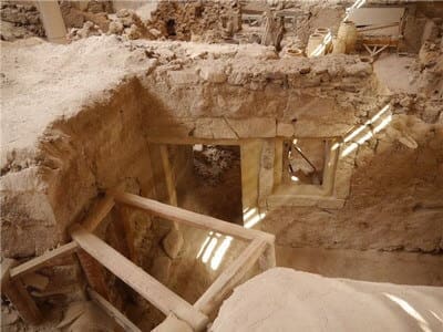
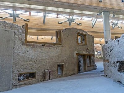
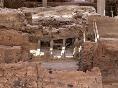
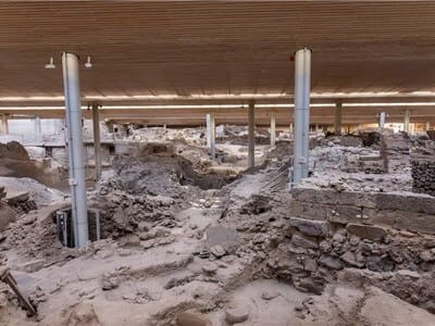
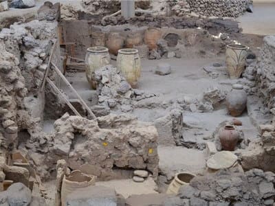
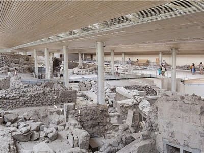
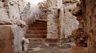
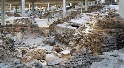
AKROTIRI
The ancient city at Akrotiri is not just the most important archaeological site on the island. But, thanks to its excellent state of preservation and the wealth of finds it has yielded, it is also the most importantprehistoric settlement found anywhere in the Eastern Mediterranean. Akrotiri could be characterised as the prehistoric Pompeii of the Aegean.
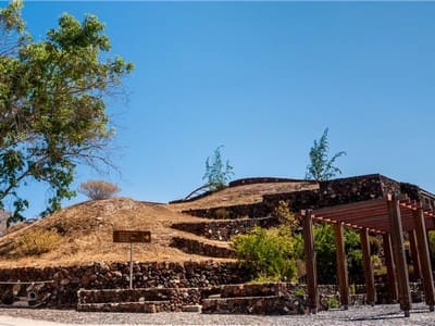
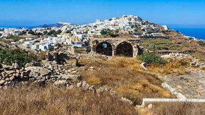
ANCIENT THERA
The strategic position of the area attracted the Lacedaemonian colonisers of the island who foundedtheir city utilizing the limestone rock of Mesa Vouno as a natural fortress. From the 9th century B.C.until the spread of Christianity, the city of Mesa Vouno was the only urban center of the island.
-
Beaches
Beaches
-
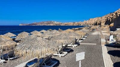
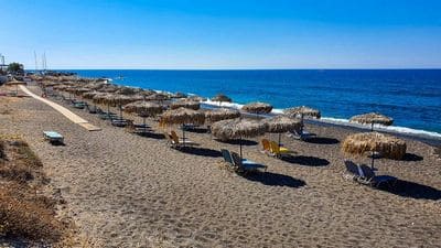
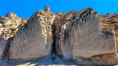
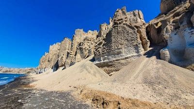
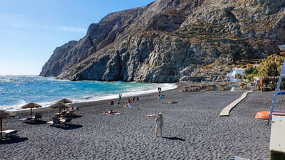
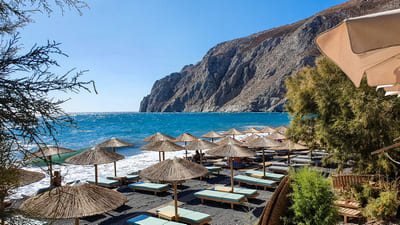
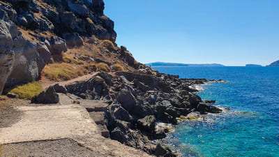
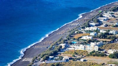
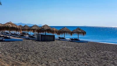
Vlychada (Eros Beach)
Vlychada (Eros Beach)
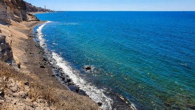
Vlyhada Beach is situated at the south part of the island, 15 km from Fira town. The beach is beautiful, composed of volcanic grey sand surrounded by high cliffs, and is the ideal spot for privacy since it is not as crowded as other beaches in Santorini. Part of the beach is organized with sun beds and umbrellas and part is left more rugged and natural. The beach itself is a long grey sandy beach with interesting rock formations and white cliffs. There are a few Tavernas and snack bars close by too. If you’re looking for a quiet and secluded beach experience then Vlychada beach is for you.
-
Vourvoulos Beach
Vourvoulos Beach
Vourvoulos is a village on the island of Santorini in Greece. It is located 3,7 kilometers northeast of the capital Fira, built on a slope facing the east shore of the island
-
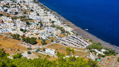
Kamari Beach
Kamari Beach
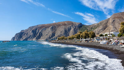
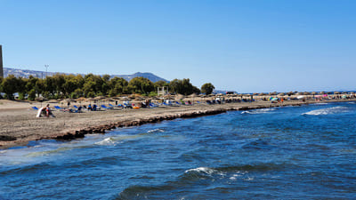
Kamari is a famous beach resort of Santorini situated 10 km southeast of Fira, the island's capital. Quite similar to the landscape of Perissa, the beach is covered by black sand while on the left side of the beach is an enormous rock called Mesa Vouno that rises from the sea. The area is extremely attractive, especially at night when the rock shines in the dark. The beach of Kamari is fully organised offering a wide range of facilities like sunbeds, umbrellas and various types of water sports.
Visitors can take a nice walk along the waterfront with fish restaurants, traditional Taverna and café bars lies just behind the black sandy beach..With clear blue waters turning quickly deep, the long grey sand Kamari Beach offers an amazing landscape and impressive views of the Mesa Vouno huge rock rising from the sea. Attracting hordes of tourists, the long beach is very organized and offers a multitude of restaurants, beach bars and shops. Due to the modern amenities including hotels, restaurants, snacks, cafes, bars and night clubs the village becomes quite popular with tourists during the peak season. From Kamari, a road takes you up the mountain to Ancient Thira, and a caique can bring you to the wild isle of Anafi
-
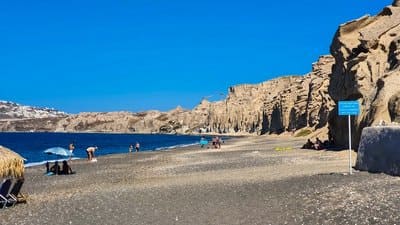
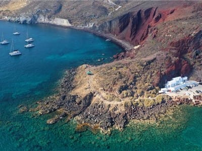
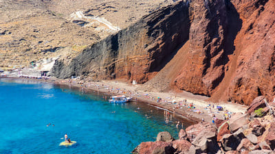
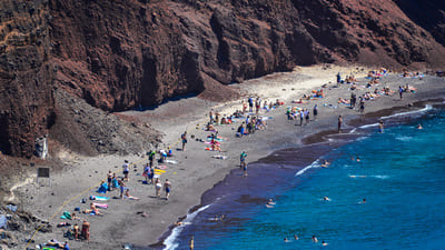
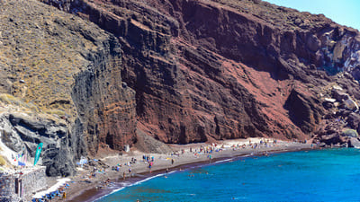
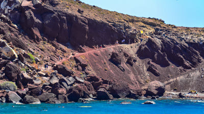
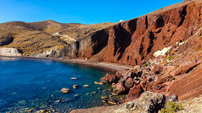
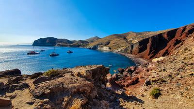
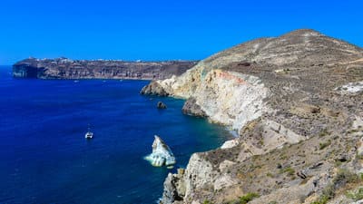
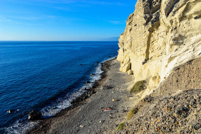
Red Beach
Red Beach
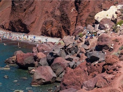
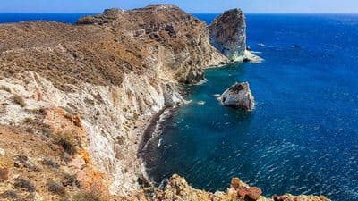
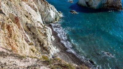
Near the village of Akrotiri, lies one of the most famous and spectacular beaches of Santorini with rare red color pebbles and rocks and clean waters. Despite the fact that the Red Beach is isolated, it attracts many visitors wishing to experience the unique scenery of its red lava cliffs cascading down to the sea.The red beach is arguably one of the most famous and beautiful beaches of Santorini. It is located only some steps away from the ancient site of Akrotiri. The small size of the beach creates a much crowded atmosphere and there are many days where most of the visitors choose not to make it all the way down to the beach and instead admire this unique landscape of red and black volcanic rocks from the headland.
The access is relatively easy. You can leave your car at the parking space and continue all the way down that takes about two minutes. As you gradually get down to the beach you will be impressed by the different colorings of the cliffs. Snorkeling is highly recommended due to the interesting rocks. You can also access the beach by boat that departs from Akrotiri port.
-
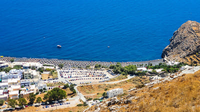
Perissa
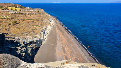
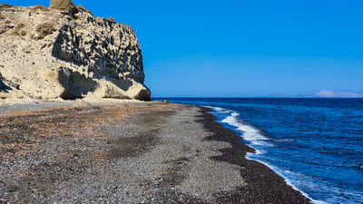
Perissa
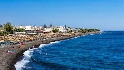
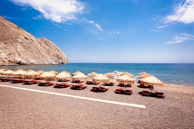
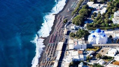
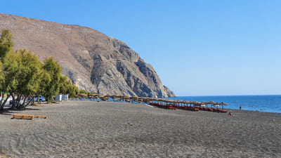
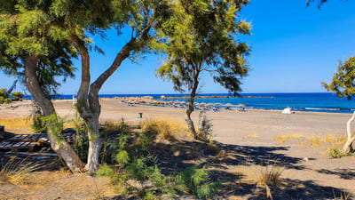
The impressive combination of black lava sand and crystal blue waters makes the long Beach of Perissa one of the most popular beaches in Santorini. Including several beach bars, taverns and sport facilities, the beach located in Perissa village is fully organized and the place to be for fun and party in the sun.Perissa is a beautiful beach situated 15 km southeast of Fira extending for 7 km on the southeastern side of Santorini. The beach features unique charateristics, black sand, crystalline waters and various beach facilities. However, the enormous rock called Mesa Vouno that rises from the sea is the main attraction of the beach and the entire area. Visitors are left spellbound by the stunning view of the rock especially when it shines in the dark.
Perissa is a nice tourist resort witnessing a huge tourist movement that starts from in the middle of the summer season. The village offers a great variety of hotels for all tastes and budgets, restaurants, taverns, cafes and bars. The area is extremely developed with modern amenities and quite inviting while retaining its strong traditional character. From Perissa, a small path crosses the mountain and leads to the ruins of Ancient Thera. The excursions can be made by foot or riding donkeys.
-
White Beach
White Beach
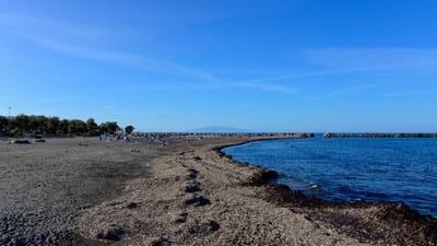
The impressive combination of black lava sand and crystal blue waters makes the long Beach of Perissa one of the most popular beaches in Santorini. Including several beach bars, taverns and sport facilities, the beach located in Perissa village is fully organized and the place to be for fun and party in the sun.Perissa is a beautiful beach situated 15 km southeast of Fira extending for 7 km on the southeastern side of Santorini. The beach features unique charateristics, black sand, crystalline waters and various beach facilities. However, the enormous rock called Mesa Vouno that rises from the sea is the main attraction of the beach and the entire area. Visitors are left spellbound by the stunning view of the rock especially when it shines in the dark.
Perissa is a nice tourist resort witnessing a huge tourist movement that starts from in the middle of the summer season. The village offers a great variety of hotels for all tastes and budgets, restaurants, taverns, cafes and bars. The area is extremely developed with modern amenities and quite inviting while retaining its strong traditional character. From Perissa, a small path crosses the mountain and leads to the ruins of Ancient Thera. The excursions can be made by foot or riding donkeys.
-
Kolumbo Beach
Kolumbo Beach
Cape Columbo or Kolumbo Beach located near Oia, represents for many, the most beautiful beach of Santorini Island. It is a unique and unspoiled long back sandy beach with pebbles, surrounded by cliffs and beautiful natural environment. Offering great views and relaxing moments since it is quite isolated, the beach is not organized and attracts many nudists.

-
Armeni Beach (Oia)
Armeni Beach (Oia)
Armeni is a small beach very close to Oia, accessible by foot, descending 300 steps, or by boat from Ammoudi bay. Not as crowded as other beaches in Santorini due to the it’s access, Armeni Beach offers clear blue deep waters and a nice local tavern where you can peacefully enjoy fresh fish or octopus.
-
Katharos Beach (Oia)
Katharos Beach (Oia)
Katharos is a virgin beach,. It is perfect for those seeking for tranquility and relaxation away from the crowds. A café/restaurant is operated at this beach.

-
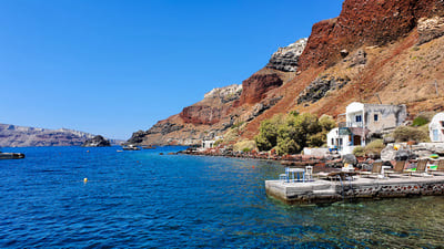
Ammoudi Beach (Oia)
Ammoudi Beach (Oia)
Ammoudi lies at the foot of Oia village. Some of the best fish restaurants in Santorini are found at Ammoudi. Walk a bit further and you can swim at St. Nicolas rocky island.
-
Paradisos Beach (Oia)
Paradisos Beach (Oia)
Paradisos beach sounds idyllic but unfortunately the beach doesn’t quite live up to its name. The sand is greyish black and there are some high waves depending on the summer winds. This makes Paradisos Beach less popular than say Perissa, Perivolos, Kamari or other Santorini beaches. It does have some sun loungers and parasols and offers the visitor a peaceful beach experience.
-
Monolithos Beach (Oia)
Monolithos Beach (Oia)
Monolithos Beach, situated close to the airport on the East of Santorini, next to Kamari Beach, is a peaceful fine black sandy beach, popular with locals and perfect for families with children as it organized with many facilities, such as children play areas, sun beds, umbrellas for rent, water sports.
-
Baxedes Beach
Baxedes Beach
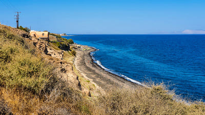
Baxedes Beach, located at the north side of Santorini, is perfect for those seeking for tranquility and relaxation away from the crowds. One of the few sandy beaches in Oia, Baxedes is a quiet black sandy beach with shade and suitable for families, friends or couples who should though be aware of the strong summer northern winds called meltemia due to the beach northern location. The beach is just 6 km away from Oia village and access is quite easy by car or motorbike.
-
Perivolos Black Beach
Perivolos Black Beach
The famous Perivolos Beach, is an extension of Perissa beach, and consists of a very long black sandy and pebbles beach that offers all sorts of facilities for fun, sport, eat and drink, with a plethora of restaurants, tavernas, beach bars inviting travelers to enjoy a true party atmosphere under the sun. Perivolos beach is an extension of Perissa Beach and leads onto Agios Georgios Beach. The sand itself is greyer than black and is course to touch. There is plenty of choice for eating and drinking too with lots of bars, cafés and fish restaurants.
-
Vlychada (Eros Beach)
-
Traditional Villages
Traditional Villages
-
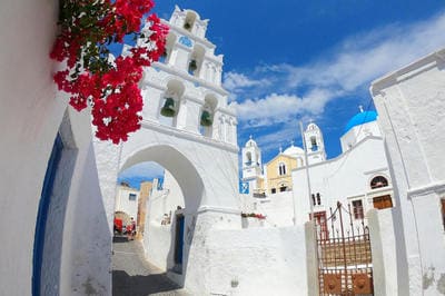
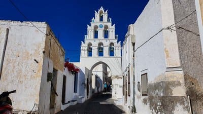
Vothonas
Vothonas
The village of Vothonas is located 3 km away from the town of Fira. It is among the most picturesque settlements of Santorini, offering a peaceful and beautiful setting for your holidays. Vothonas village is built on a picturesque ravine with traditional houses which are literally carved out of rocks. A stroll around the paved streets leaves any visitor spellbound by the creativity of the craftsmen who knew how to protect their houses from violent storms. Vothonas is characterized by this unique layout and stylish details that match perfectly with the white domed churches and the traditional houses.
The trip to Vothonas village would be incomplete without visiting the magnificent church of Agia Anna,the oldest church of the village that dates back to 1827. The most beautiful part of the church is actually the carved wooden panel, which artistically portrays scenes from the Old Testament. If you have enough energy left, you may as well visit the pretty chapel of Panagia Trypa located on the edge of the cliff. The walking trail is about 20 minutes
-
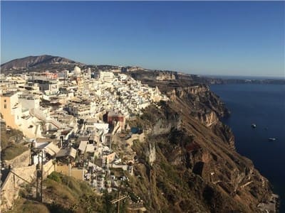
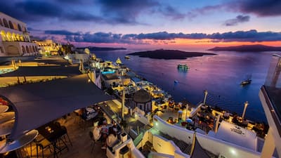
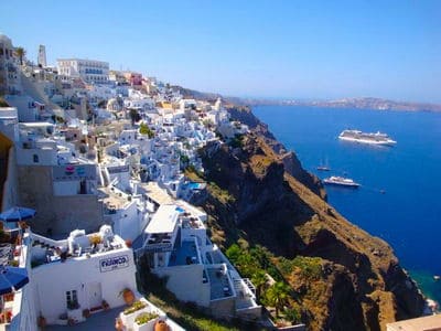
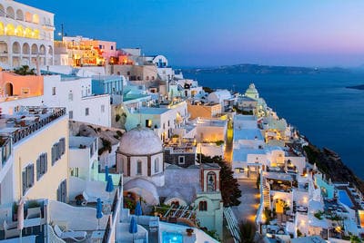
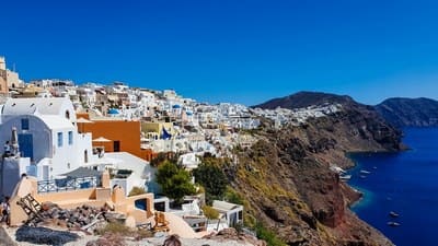
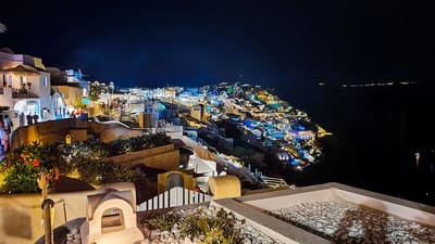
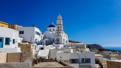
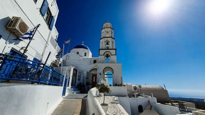
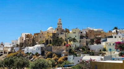
Fira
Fira
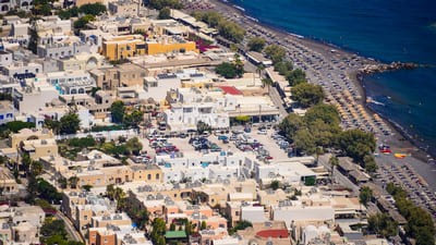
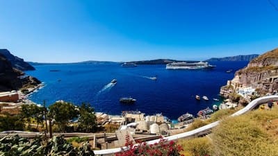
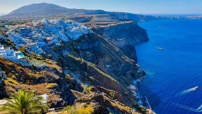
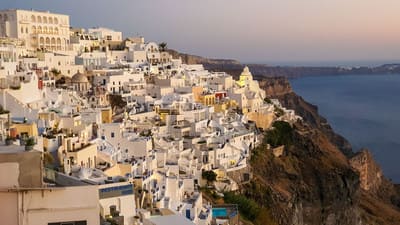
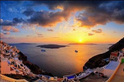
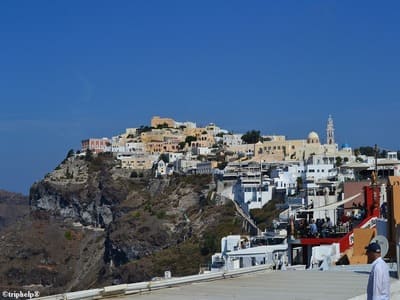
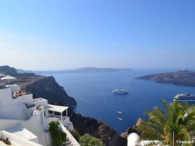
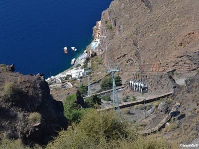
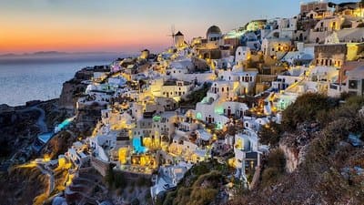
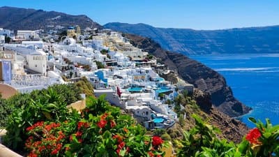
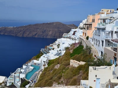
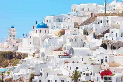
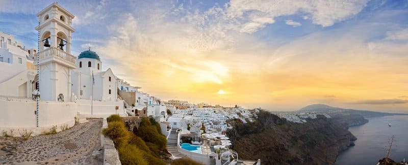
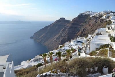
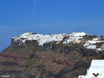
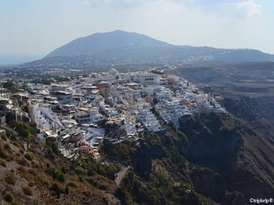
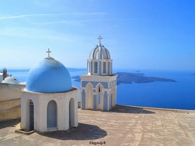
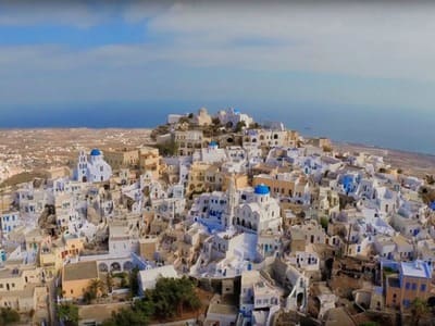
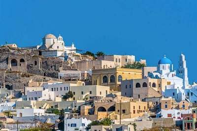
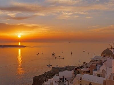
Fira is the capital of Santorini, Greece, and the most important of all villages. It is located at the west side of the island and 10 km away from the main port, Athinios. Fira has 1,600 permanent inhabitants. It is perched on the edge of an impressive cliff, at a height of 260 meters offering a great panoramic view over the submerged volcano.
In 1956, the island of Santorini was hit by an earthquake that destroyed a large part of the island but luckily, some of the 18th century buildings were saved. The town of Fira is a typical Cycladic village made of charming white houses with blue windows and doors, separated from each other by small paved streets.
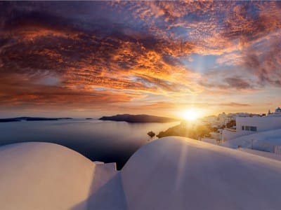
Many of its beautiful buildings were constructed back in the times of the Venetian invasion, including some blue domed churches and sun-bathed verandas that offer an incredible view of the volcano and the sunset. In our days, Fira is a busy town.
During summer and in its high season, the central streets are overcrowded with tourists and filled with all kind of shops, jewelleries, restaurants, cafes, bars and night clubs. The caldera is considered the highlight of Santorini but there are some interesting churches that attract attention as well as the sheer beauty of the town's architecture. Despite all the tourist traffic concentrated in town, there are some areas that remain quiet.
Thus one will definitely find places to relax and enjoy a great view of the island and the surrounding area. For those in search of a knowing better the culture of the island, an Archaeological Museum hosting many items from several excavations conducted in the ancient Minoan settlement of Akrotiri can be visited in the town of Fira. The town displays also numerous churches and monasteries such as Agios Minas, the cathedral of Ipapanti, the cathedral of Christ, the monastery of Panagia ton Dominikanidon, Panagia tou Rodariou and the Catholic Cathedral.
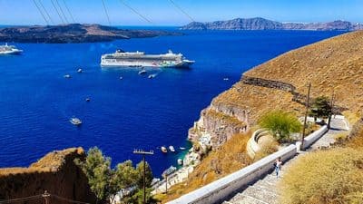
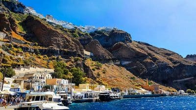
A nice proposal is also the Megaron Gyzi Museum with its fascinating collection of photos of Fira before and after the earthquake of 1956. Fira also has a port that was, for many years, the main port of Santorini. Today, this port is only used for cruise boats. From there, boats can take visitors for a tour to the volcano of Nea and Palia Kameni.
-
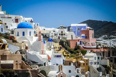
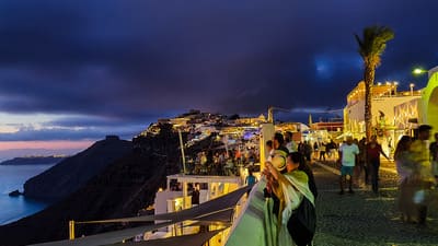
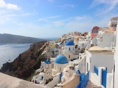
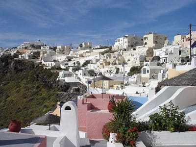
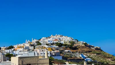
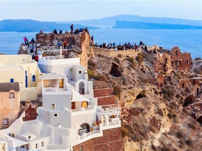
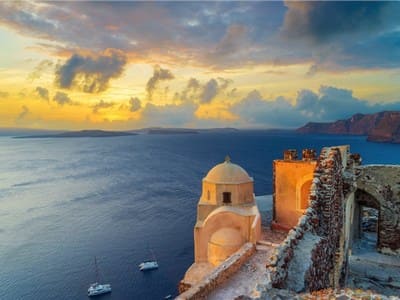
Oia
Oia
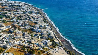
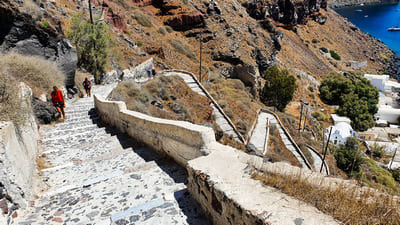
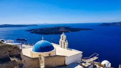
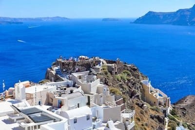
Oia, pronounced Ia, is the most famous of all villages of Santorini. It is known throughout the world for its quiet life and fantastic sunset, and is certainly the most beautiful and picturesque village of Santorini. The village is also situated on top of an impressive cliff and offers a spectacular view over the volcano of Palia and Nea Kameni and the island of Thirassia. Oia is situated on the north of the island, 11 km away from Fira.
It is a traditional village with charming houses in narrow streets, blue domed churches, and sun-bathed verandas. Its streets have plenty of tourist shops, taverns, cafes, and other shops. Oia is much more quiet that Fira and the busiest area is the main pedestrian that runs along its length. At the entrance of the village is a car park where visitors can leave their vehicle and enjoy long walks in the picturesque paths. The volcano from here is much less imposing but you can still get some gorgeous views. Oia has several cultural attractions like the Maritime Museum which houses a small library, items from the maritime life of the area, and the vestiges of a Venetian fortress. Many artists fell in love with the area and settled there. For that reason, the village of Oia has many art galleries. Oia also has a small port, Ammoudi, which can be reached by a set of 300 steps leading down. There, small boats can take you opposite, to the island of Thirassia. The beach of Armenis is also located there. Taverns in Oia offer visitors tasty meals of fresh fish.

-
Imerovigli
Imerovigli
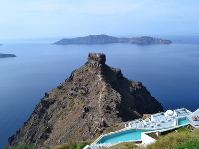
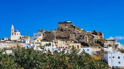
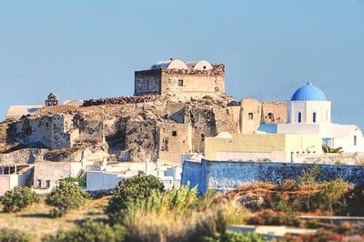
Immerovigli is a picturesque village situated at the north of Santorini, only 2 km away from the capital of Fira. It is a continuation of Fira and one of the most beautiful balconies of the island. The name of Imerovigli comes from the word vigla which means view spot. The position of the village provides a clear view of the caldera, and during the old times it allowed villagers to see the pirate ships approaching. Today, Immerovigli is one of the recognized traditional settlements. There are also many taverns and cafes with stunning views to the caldera. In front of Immerovigli lies an enormous rock called Scaros.On top of it is a castle that was built during the 13th century but it was abandoned in the early 1800s. The castle housed all the administrative offices of the island. This part of the island collapsed after an earthquake, and only the huge hill of Scaros is left today. Immerovigli has numerous chapels and churches built on the rocks overlooking the blue sea. The village is known as the ultimate romantic destination.


-
Firostefani
Firostefani
Firostefani lies to the north of Fira and there is little difference that separates it from its considerable larger neighbour. Without a doubt, the views from this part of Santorini are spectacular, offering another perspective of Santorini volcano. One can enjoy the magnificent sight of Fira itself and the breathtaking sunset in the evening.The village has plenty of restaurants and cafes located on the most fabulous locations. Between the village of Firostefani and Imerovigli lies the Agios Nikolas Monastery.
-
Pyrgos
Pyrgos
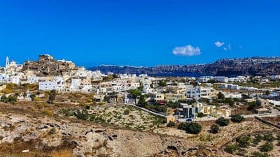
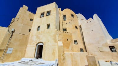
Pyrgos is situated 8 km southeast of Fira. The village is located on a fabulous spot on top of a hill and displays incredible panoramic views of the island. At the bottom are some nice taverns, a shop that stocks international press and the usual tourist shops.
Pyrgos used to be the capital of the island until the early 1800s. Today, the village of Santorini counts more than 500 inhabitants and it is well-known for its major tourist movement. The village consists of traditional houses built all around the Venetian castle, and the small streets that follow the natural flow of the surrounding landscape. The houses are the perfect example of Cycladic design and in superb condition.
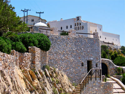
The Venetian castle is one of the five on the island of Santorini and dates back to the 13th century. The fortfied settlement is amphitheatrically built on the hill and offers superb views of both sides of the island. The village has many churches: the church of Theotokaki with its beautiful frescoes and old icons, Agia Triada, the church of Agia Theodosia, the Archangel Michael and many others. The most famous church of Santorini is also found just 4 km from Pyrgos, the Monastery of Prophet Elias which is built at the highest spot of the homonymous mountain. It hosts a small collection of ethnographic material and old icons.
-
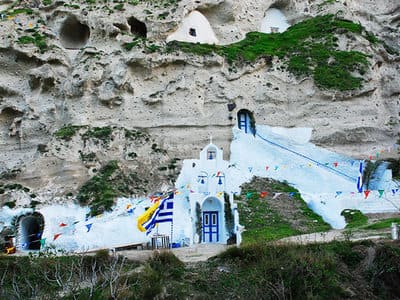
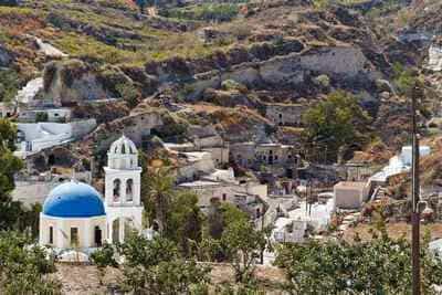
Akrotiri
Akrotiri
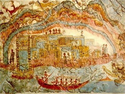
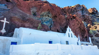
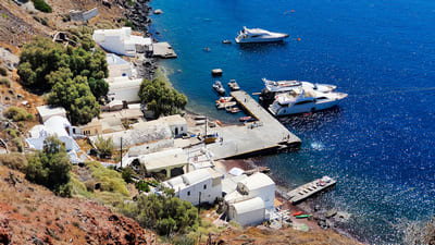
Akrotiri is located next to the famous Red Beach. It is ampitheatrically built at the southeastern side of the island. Akrotiri was originally a Minoan settlement and today is one of the major tourist attractions and the most important archeological site of Santorini. The prehistoric town was destroyed due to a massive volcanic erruption around 1600 BC. Nowadays, the picturesque streets, the two-storey buildings, the lovely frescoes and plenty of tools witness the way of life in the prehistoric times. Today, the beautiful frescoes of the ancient city of Akrotiri can only be seen in the National Archaeological Museum of Athens. Some splendid houses are dotted around the village as well as a traditional windmill. Many tour boats arrive in Akrotiri and tourists are scattered to the nearby beaches of the area. Another place of interest is the Venetian castle that dominates the settlement of Akrotiri. The town has many local taverns with a splendid view to the sea. Akrotiri has plenty of churches to visit and one of the most beautiful is the church of Agios Nikolaos built right above the impressive redish rocks, on the way to the Red Beach.
-
Megaloghori
Megaloghori
One of the most traditional Villages of Santorini, Megalohori lies on a hill creating a labyrinth of steep alleys and streets. The uncountable vineyards which extend beyond the countryside offer a magnificent setting and the top quality wine in Santorini. Megalochori is definitely a place to experience the rich wine tradition. The famous Boutari winery is found on the village's outskirts. Megalochori offers a nice mix of white Cycladic houses, several churches and narrow alleys witnessing the strong Aegean tradition. Follow the road to the main square that hosts a couple of nice taverns serving delicious food.
-
Messaria
Messaria
Messaria is a small quaint village situated 3km southeast of Fira, around a vast area of vineyards at the centre of Santorini. Most of the inhabitants are occupied with wine making and there is a local winery to see and taste a wide range of wine flavors. A stroll around the village reveals magnificent neoclassical buildings and restored mansions. Between them are numerous taverns and nice accommodation. The roads are very busy during the day as it is on the main thoroughfare for getting around much of the island. You can sit at the main square for a nice Greek coffee under the trees. In Messaria you can find a few yet beautiful churches with impressive bell towers that dominate the area. Visit Argyros mansion, one of the best examples of neoclassical architecture in Santorini built in 1888.
-
Emporio
Emporio
Emporio is the largest settlement of Santorini located 12 km from Fira on the foothills of Mount aProphet Elias. The village itself has a strong medieval character and most of the houses have been well-preserved. At the entrance of the village stand two lovely, blue domed Cycladic churches with impressive bell tower that dominate Emporio. Half way up the village is a 15th century fortress which looks as though it will slide down the hill at any moment.
-
Vothonas
-
Geology & Geography of Santorini
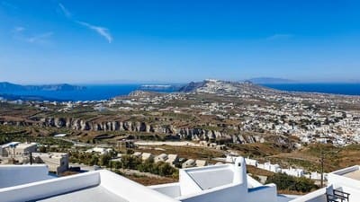
Geology & Geography of Santorini
The Cyclades are undoubtedly a classic representation of all the Aegean has to offer. A timeless landscape of white washed villages on desert like islands, sapphire blue sea melting into the deep blue sky, weaved with scented summer warmth and greek music along the waterfronts.
The name Cyclades (Circular) derives from the fact that the islands surrounded the ancient Greek shrine on Delos. Coincidentally the islands also lie at the geographic center of the Aegean. Santorini is a small circular shaped archipelago of islands of volcanic origin, located in the south Aegean sea, and is the most southern of the Cyclades group of islands. The archipelago consists of the horse-shoe shaped main island of Thera and the smaller island of Therasia, across the lagoon within which we can see the two volcanic cones of Palea and Nea Kameni plus a couple of islets.
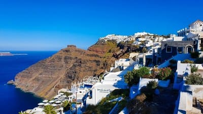
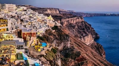
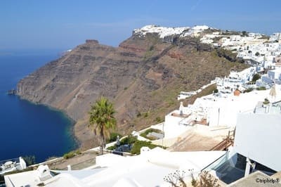
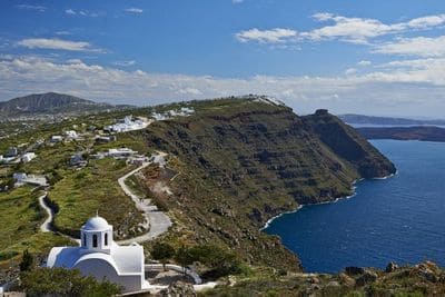
The caldera is the physical incarnation of the island’s history. The sharp and beautiful scene of circumventing steep cliffs is the remnant of what was probably the largest volcanic explosion in human history. Santorini was once a complete island. A large mountainous, roughly circular land mass, with a typical central volcanic peak. Thousands of years ago, during the final throws of a major eruption, the implosion of the magma chamber resulted in the sea flooding the massively enlarged caldera, forming one of the largest crater lakes on earth and creating the beautiful scenery we see today.
The floor of the caldera lies generally between 200m and 400m below sea level, representing a total drop between cliff top and sea bed of over 700m. The clearly defined and variedly colored strata of the cliff face, as seen from the water are a legible section through the geological history of the island. The eruption itself was so great that the airborne volcanic ash in the stratosphere provoked a period of climatic cooling around the world. It altered the entire course of history in the Eastern Mediterranean and it may be the central event at the heart of the myth of Atlantis, recounted by Plato.
-
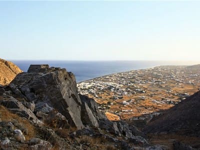
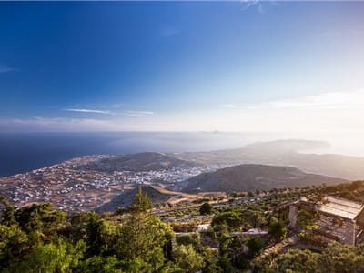
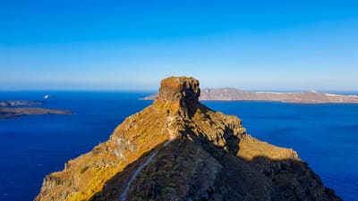
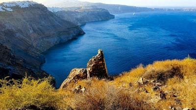
Sights to Visit, for Views and Photographs
Sights to Visit, for Views and Photographs
Walk from the castle, west edge of the village, to the east edge of the village
Path from Oia to Fira
FIRA
From Oia to Akrotiri
Stop anywhere the road allows you to view the caldera cliff side
Ancient Thira
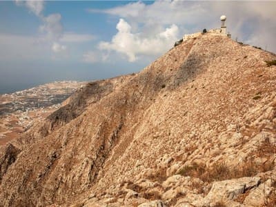
Profitis Ilias at Pyrgos
Santorini's highest point,affording panoaramic views of the island and out across the sea. Here stands the mighty Profitis Ilias Monastery, an 18th century sanctuary that is open to the public
skaros castle at Imerovigli
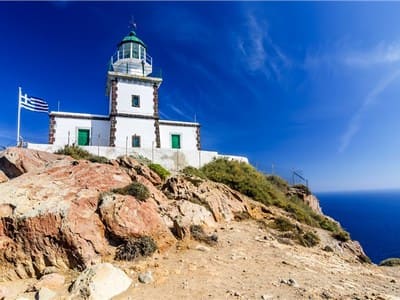
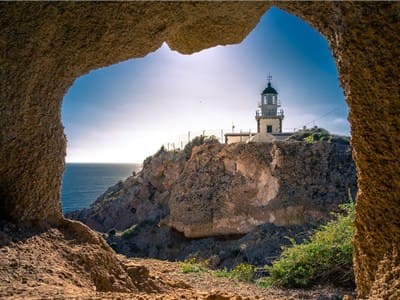
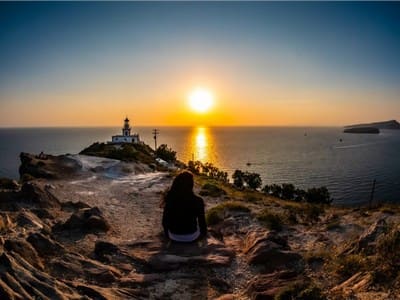
Akrotiri light house
Megalochory
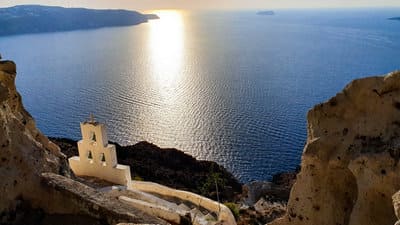
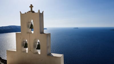
Heart of Caldera
-
History & Myth of Santorini
History & Myth of Santorini
Santorini is an astonishing natural phenomenon; but its human history, archeology and past, are no less mesmerising. For its small size, it has one of the richest and most varied archeological histories of any island. The volcanic nature of Santorini, even before the great eruption during the 2nd millennium BC, has always shaped its existence.
The Minoan eruption was one of the worlds largest volcanic events in the last millennia. The collapse and subsequent explosion resulted in a massive tsunami and major environmental change across the whole northern hemisphere. No trace of the islanders themselves has yet been found, but the present theory is that this event brought about the demise of the Minoan civilization.
A description of Atlantis as written by Plato shows a striking resemblance to Santorini. In his account Plato describes quarries on the island of Atlantis were “rocks of white, black and red were extracted from the hills and used to construct a great island city”. This description matches the composition of rocks found in Santorini. Also, one of the frescos discovered at the archeological site of Akrotiri, painted before the eruption in this ancient dwelling, resembles Plato’s description of the mythical Atlantis. All these, bring about the theory that Santorini may have been one of the possible locations of the fabled island of Atlantis.
According to evidence found in Santorini’s main archeological sites, the first human presence dates back to the Neolithic Period. Traces of settlement on the island found on Akrotiri date to around 3600 BC and confirm the island was inhabited by either the Minoans, or people with a very similar culture, as discoveries made at Akrotiri and Red Beach confirm.
The ancient dwellers of the island were most certainly, highly sophisticated and cultured people. Much of the Art found is in the style of Knossos of the island Crete, with many wall paintings and pottery depicting naturalistic landscapes of animals and people in ancient Minoan style.
At the site of Ancient Thira, on the peak of Mesa Vouno 396m above sea level, one can find the remains of a main Hellenic city founded by one of the 4 ancient greek tribes, the Dorian, circa the 9th century B.C. It was one of the first Aegean centers to adopt the Phoenician alphabet for writing the Greek language. In the late 6th century BC it minted its own coins, bearing the motif of two dolphins.
In the 4th century, a christian bishop, named Dioscorus lived on the island, whose seat was probably the Basilica of St. Irene at Perissa, after which the island was later named. In its history Santorini was also ceded as a marriage dowry to the Duke of Crete in 1480, and attacked by Khaireddin Barbarossa in 1537. The Santorini fleet contributed considerably to the Greek War of Independence and in 1832 the island officially became part of the Greek State.
One could plan a whole day around Greek Archeology with visits to the excavations of Ancient Thera, and the Minoan ruins of Akrotiri followed by a visit to the museum to see the exquisite mosaic masterpieces. Stroll the many cobblestone lanes of the picturesque villages, deciphering the history that is written in the architecture and mingle in the stories and culture of the place and its people.
The diverse monuments of Greece belong to a cultural continuum, which extends far beyond the country borders. Santorini has a rich history and culture that can be enjoyed throughout the island, which has also made its impact throughout the western world.